Share
This article initially appeared in The State of Open Humanitarian Data 2025.
Understanding population dynamics before, during and after sudden-onset and protracted crises is critical for effective humanitarian response. Rapid assessments of people and their movements after a crisis aids the prioritization of response efforts. In this context, WorldPop works to ensure that every person is mapped and counted in decision-making. Their innovative approach to population estimation has been impactful across all stages of response and recovery.
WorldPop is based at the University of Southampton and maps populations across the globe. Since 2013, they have partnered with governments and UN agencies to produce more than 45,000 datasets, complementing traditional population sources with dynamic, high-resolution data for mapping human population distributions.
“At WorldPop, we believe that high-quality population data is essential for effective humanitarian decision-making. Advances in statistical methods, satellite imagery and AI have enabled us to enhance the accuracy and detail of population estimates, especially in areas where traditional census data are outdated or unavailable. By sharing our latest global population estimates on HDX, we hope to provide data that can support humanitarian organizations to respond quickly and effectively to crises.”
-Professor Andrew Tatem, Director, WorldPop
WorldPop has been a valuable partner of HDX since 2016, sharing over 1,000 datasets covering population counts, age and sex structures, births, and population density for 248 countries and territories. In 2024, these datasets were downloaded over 76,000 times on HDX with over 381,000 unique users visiting the WorldPop page. WorldPop was the first organization to feature in our HDX Dataset Deep Dive webinar in 2020, where the team shared their high-resolution population estimate methodology.
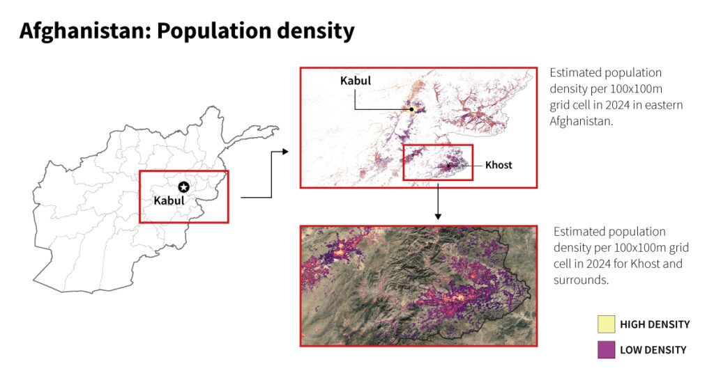
In late 2024, WorldPop began the process of updating its data on HDX with the latest collection of new global population estimates. This includes two new datasets for all countries in the world: spatial distribution of population, and age and sex structures. These datasets represent estimates of residential population from 2015 to 2030 for each 100x100m grid.

Population data matched to sub-national boundaries was collected from the 2010 and 2020 census rounds. In countries without census data, estimates and projections were used. A key advantage of small-area gridded population datasets is their ability to be summarized and aggregated at various scales, to facilitate interoperability with other datasets on HDX.
The spatial distribution of population (2015-2030) data is a complementary dataset under the populated places sub-category of the HDX Data Grids.
WorldPop data is built through partnerships with institutions, spanning Jade University of Applied Sciences and Columbia University for boundary-linked population data, tech companies and satellite imagery providers for geospatial libraries, and UN agencies and governments to develop and disaggregate small-area population estimates. This also includes Meta, where WorldPop is partnering on its training data to create high-resolution maps, and ESRI, where WorldPop provides the population data in its Living Atlas.
We are grateful to WorldPop for their close partnership with HDX. We hope that other organizations will be inspired by their commitment to making data openly available and easy to use for analysis. Please reach out with questions or comments at hdx@un.org.